Our country is a land of extreme weather. Over the course of the last week we have had bushfires continue to ravage parts of the country, extreme dust storms in central New South Wales, and torrential rain along parts of the east coast that has seen widespread damage and flash flooding. What’s next? A heatwave warning for the East coast over the coming days.
The NSW SES and the ACT ESA have responded to a record number of calls after the storms that hit New South Wales and the ACT yesterday afternoon. Over the last two years, the ACT State Emergency Service has averaged an annual storm response of approximately 600 jobs.
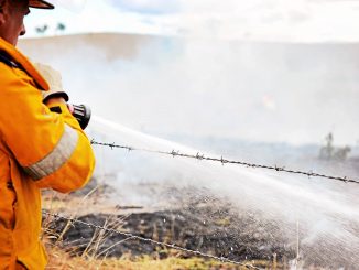
Yesterday, The ACT ESA received more than 1,900 calls for help since midday. Currently, 445 jobs have been complete and there are 1,466 jobs outstanding. Approximately 35 operational crews made up of ACTSES, ACTRFS, ACTF&R and TCCS were busy working overnight. This comes obviously after these same agencies have been battling bushfires over the last month.
NSW SES Assistant Commissioner, Paul Bailey is urging residents to prepare for the upcoming wet weather season.
“While the rain is welcomed, heavy rainfall and storms in fire affected areas can lead to dangerous conditions such as a higher risk of flash flooding, falling trees and landslips,” said Mr Bailey.
“In areas impacted by fires where vegetation has been destroyed, water from heavy rainfall can flow into riverbeds and we could see run off in areas we wouldn’t normally, resulting in flash flooding.
“The NSW SES is also asking residents in fire affected areas to watch for possible landslips as the ground and roads can be damaged, therefore creating a higher risk of a potential slip,” continued Mr Bailey.
The NSW SES is advising people to prepare their homes and businesses now.
“People can help prevent storm damage around their properties by trimming back overhanging branches, cleaning gutters and downpipes and securing or putting away loose items around the yard or balcony. It’s also important to avoid parking your cars under trees and powerlines,” added Mr Bailey.
Whilst some parts of New South Wales that have been decimated by bushfires received some much welcome rain, other parts were not so lucky. In NSW’s west they recorded the worst dust storms to have hit the region. It spread from Broken Hill to Nyngan, Parkes and Dubbo. The dust storms plunged the towns into complete darkness and high wind gusts were recorded.
So what to expect over the next week or so with such instability. A heat wave will hit the east coast over the next four days with temperatures expected to 5 degrees over the average. Fire dangers will increase again with wind shifting and bringing with it drier and warmer air. Rain will be seen again around the weekend, hopefully bringing relief to those areas that didn’t receive any over this last weekend.
If the current weather news is anything to go by, we should be prepared for anything.
To stay on top of weather in your local area visit the Bureau of Meteorology at www.bom.gov.au