
Emergency WA, the State’s official website for emergency information and warnings has received a $200,000 upgrade in preparation for the upcoming bushfire and cyclone seasons.
The updates to emergency.wa.gov.au, which is managed by the Department of Fire and Emergency Services, were driven by community feedback, following requests for more information and increased functionality.
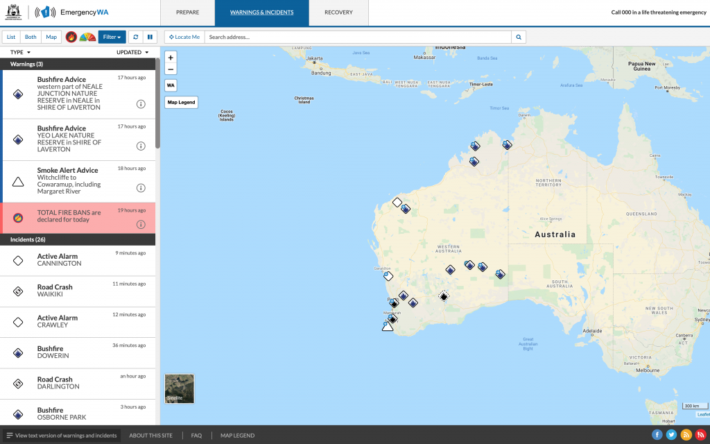
Communities impacted by bushfires will now be able to see an Incident Area for selected fires, showing the estimated location of the hazard. The Incident Area is depicted on the map as a hatched shape alongside the existing warning areas.
Fire and Emergency Services Commissioner Darren Klemm AFSM said the inclusion of the Incident Area would help people make informed decisions to respond to emergencies.
“The Incident Area is an indication of where the fire has been and gives the public a greater understanding of what’s going on during significant bushfires,” Commissioner Klemm said.
“The Incident Area is informed by on-the- ground and aerial intelligence, however emergencies can escalate quickly and the shape might not show the full extent of the incident.
“Always follow the advice in official warnings and never solely rely on the Incident Area when making decisions in an emergency.”
Among the recent upgrades to Emergency WA is the customisation of the platform to include future WA Health-issued community COVID-19 alerts and warnings.
Since its launch in October 2016, Emergency WA has gained a strong community following with 5.4 million visitors and over 32 million page views.
To date, its busiest day was 9 January 2020, with 274,468 visitors in 24 hours. This coincided with bushfires in Norseman, the Stirling Ranges and Baldivis and storms and flooding in the State’s north west.
“Following the Black Summer bushfires in the Eastern States, Emergency WA has been tested to withstand huge spikes in website traffic in the event of a catastrophic incident,” Commissioner Klemm said.
“We have also listened to feedback from the community and worked to make Emergency WA more user friendly with several new features and optimisations to provide clear, and easy to understand information during emergencies.
“Emergency WA is the official source of emergency information for all Western Australians, no matter where they live and what hazards they face.
“With the bushfire and cyclone seasons almost upon us, I urge people to spend time familiarising themselves with Emergency WA, ahead of the upcoming busy summer period.”
Other upgrades to Emergency WA include:
• A new menu allowing users to filter map layers by hazard
• Home page icons for total fire ban and fire danger ratings
• Zoom function and warning display optimisation to make it quick and easy to find out more information about an incident
• Road names now appear in the satellite view
• Accessibility updates to ensure the website supports the information needs of people with disabilities
• Extensive security testing
To stay informed during emergencies:
• Visit Emergency WA – emergency.wa.gov.au
• Call 13 DFES (13 3337)
• Follow DFES on Facebook or Twitter
• Listen to ABC or 6PR Radio
